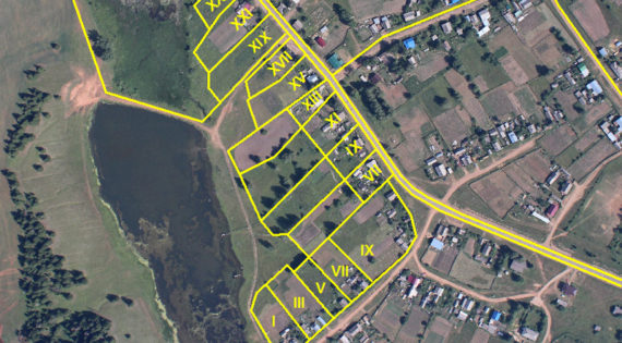
Demarcation and Boundary Survey Qualified and experienced land surveyors we are constantly involved in every element of property boundaries and demarcations; whether it is positioning undefined boundaries or assisting in resolving boundary disputes between neighboring owners. We are often instructed to act as an expert witness in boundary disputes and asked to provide the court with detailed boundary survey reports, evidence and statements to resolve ownership disagreements.... Read MoreDemarcation and Boundary Survey

GPS Surveying GPS STANDS FOR GLOBAL POSITIONING SYSTEM GPS is a highly accurate navigation system using signals from satellites to determine a location on the Earth’s surface, irrespective of weather conditions. It is dependent on GPS satellites high above the Earth which transmits signals containing the time and location of the satellite. Any ground-based receiver... Read MoreGPS Surveying

Speed and Delay Survey This survey evaluates the quality of the traffic movement along a route and identifies the location, cause, and extent of the delays in the same route. Travel time may be defined as the total elapsed time of travel, including stop and delay, necessary for a vehicle to travel from one point... Read MoreSpeed and Delay Survey

Road Inventory Survey This is a comprehensive survey which can be used to study the profile of the roads in the area of study features like road/Pavement widths, road pavement types, street lighting, luminosity, drain types, encroachments, presence of vendors/street furniture, bus stops etc. can be studied and detailed resulting in the most accurate and... Read MoreRoad Inventory Survey

Equipment Rental Services When you need access to quality equipment, ALCON has you covered. If you need to rent a high-quality Trimble, Leica unit, we will have what you need. You cannot afford to not be in the field, so contact us today with what you need and we will help you any way we... Read MoreEquipment Rental Services

As-Built Surveys Construction as-builts are used to show the finished condition of the work as it was actually constructed and accepted. The as-built documentation is a usual and important requirement of construction contracts, and the process requires that any change that modifies the original design be incorporated by drafting the change upon one set of... Read MoreAs-Built Surveys
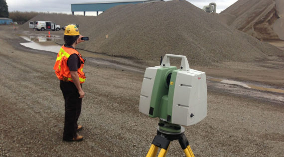
Quantity/Volume Surveys Volume is defined as the amount of material occupying a certain space, expressed in cubic units, as in “cubic yards.” Data obtained from engineering design surveys are used to calculate earthwork quantities. The standard method for calculating earthwork quantities is the average end area method. Read MoreQuantity-Volume Surveys

GIS Data Collection Survey data can be directly entered into a GIS from digital data collection systems on survey instruments using a technique called coordinate geometry (COGO). Positions from a global navigation satellite system (GNSS) like Global Positioning System can also be collected and then imported into a GIS. GIS software adds intelligence to spatial data, whether the data is generated... Read MoreGIS Data Collection

Pipeline Surveys Alcon has extensive experience surveying oil and gas pipelines. Whether it is a small project or a project that will require multiple phases and multiple years, Alcon has the equipment, the knowledge, and the experience to manage any pipeline survey with our Professionals. Alcon has performed pipeline construction surveys including construction staking and... Read MorePipe Line Surveys

Topographic Survey A topographic survey locates all surface features of a property and depicts all natural features and elevations. In essence, it is a 3-dimensional map of a 3-dimensional property showing all natural and man-made features and improvements. Specifically, it shows their location, size, height and any changes in elevation. Surveys that are generally conducted... Read MoreTopographic Surveys