

Demarcation and Boundary Survey
Demarcation and Boundary Survey Qualified and experienced land surveyors we are constantly involved in every element of property boundaries and demarcations; whether it is positioning undefined boundaries or... Read MoreDemarcation and Boundary Survey

GPS Surveying
GPS Surveying GPS STANDS FOR GLOBAL POSITIONING SYSTEM GPS is a highly accurate navigation system using signals from satellites to determine a location... Read MoreGPS Surveying

Speed and Delay Survey
Speed and Delay Survey This survey evaluates the quality of the traffic movement along a route and identifies the location, cause, and extent... Read MoreSpeed and Delay Survey

Road Inventory Survey
Road Inventory Survey This is a comprehensive survey which can be used to study the profile of the roads in the area of... Read MoreRoad Inventory Survey

Equipment Rental Services
Equipment Rental Services When you need access to quality equipment, ALCON has you covered. If you need to rent a high-quality Trimble, Leica... Read MoreEquipment Rental Services

As-Built Surveys
As-Built Surveys Construction as-builts are used to show the finished condition of the work as it was actually constructed and accepted. The as-built... Read MoreAs-Built Surveys
Quantity-Volume Surveys
Quantity/Volume Surveys Volume is defined as the amount of material occupying a certain space, expressed in cubic units, as in “cubic yards.” Data... Read MoreQuantity-Volume Surveys
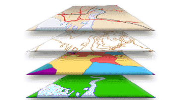
GIS Data Collection
GIS Data Collection Survey data can be directly entered into a GIS from digital data collection systems on survey instruments using a technique called coordinate geometry (COGO). Positions... Read MoreGIS Data Collection

Pipe Line Surveys
Pipeline Surveys Alcon has extensive experience surveying oil and gas pipelines. Whether it is a small project or a project that will require... Read MorePipe Line Surveys

Topographic Surveys
Topographic Survey A topographic survey locates all surface features of a property and depicts all natural features and elevations. In essence, it is... Read MoreTopographic Surveys

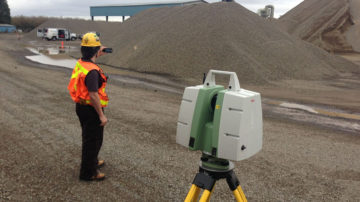
3D Laser Scanning
3D Laser Scanning If you’re looking to decrease your labor expenses, improve material cost estimations and save time planning your next construction project,... Read More3D Laser Scanning

Drone Mapping Survey
Drone Mapping Survey The use of unmanned aerial systems (UAS) is rapidly expanding as geospatial and construction companies learn how much easier and... Read MoreDrone Mapping Survey
PHONE
+968 24266707
Barka
PO Box: 972, Postal Code: 320, Barka, Sultanate of Oman
EMAIL:
info@alconllc.com